
Central Maoxian: near where the Min and Heishui rivers meet, is the town called Shaba (沙坝). The visitor’s map shows little more than a location pin with the name of the town. I had heard no rumors and received no previews beforehand. Just a name. But for those that enjoy exploring, it’s the kind of place that sincerely shatters expectations. Especially so when there are none to go off of.
Ordinary and unremarkable roadside assemblies are an unassuming gateway to a deep and captivating collection of locales. In particular for the individual that likes to go-by-foot, without a map or some list dictating. Let the eyeballs guide for this one.
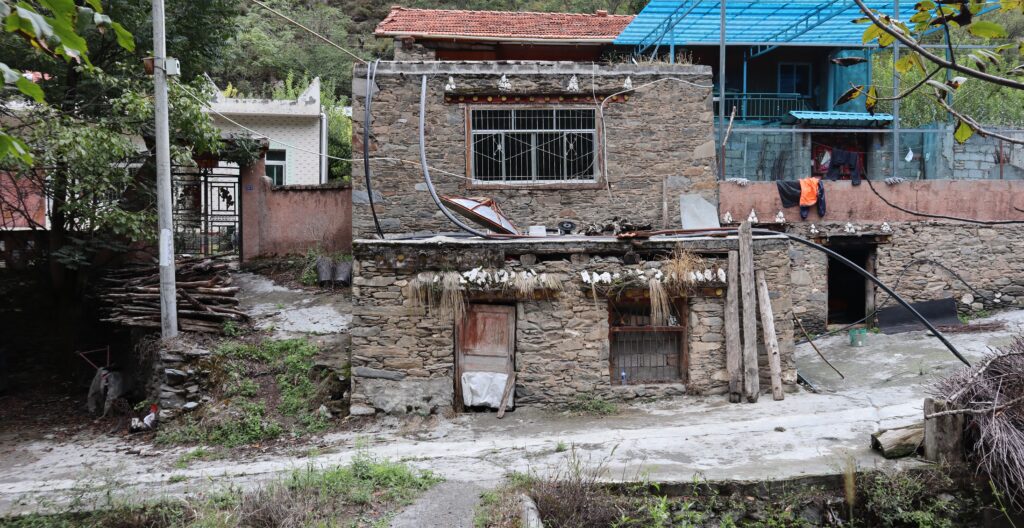
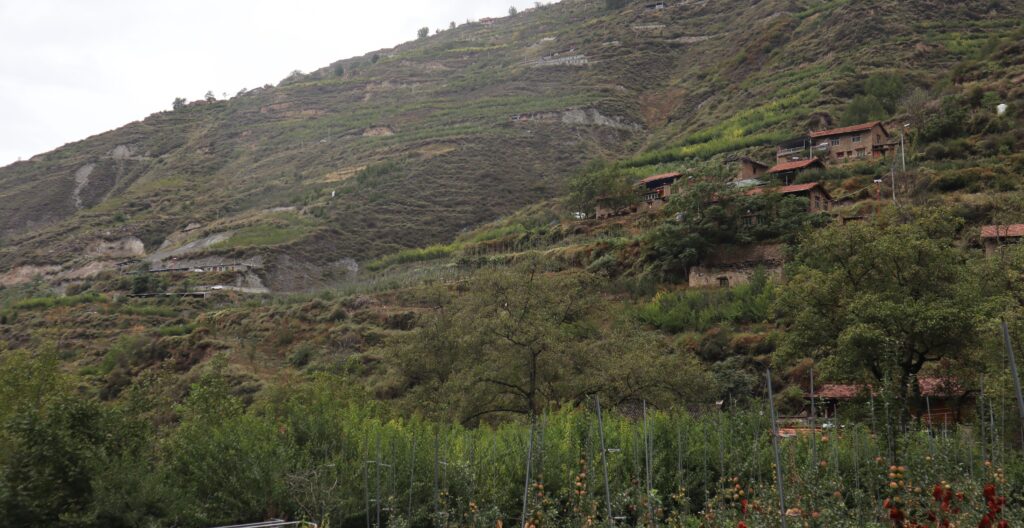
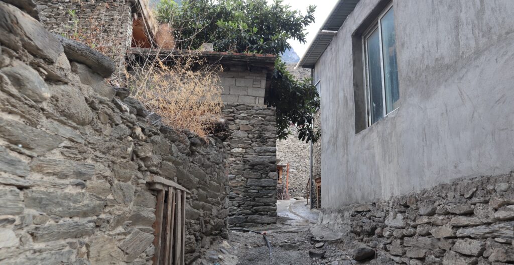
My starting point in Shaba is like a lot of places, which I have the fortune of getting to see so many. It’s standard. Not much “welcome art” or anything like that. No loop to sample. Just one road and the small street and alley offshoots- which eventually become more like footpaths. There is a considerable slope which creates an illusion of stratum and depth. Maybe not an illusion, actually.
Shaba isn’t far from another town I’ve been to, and written about. Wadi is close by. Close enough that I’m still confused when it comes to periphery places and whether they are Wadi or Shaba. Municipal decisions play a part in that too. Towns get merged or name-changed, boundaries redefined, all in recent decades. But there’ll be more on that later.
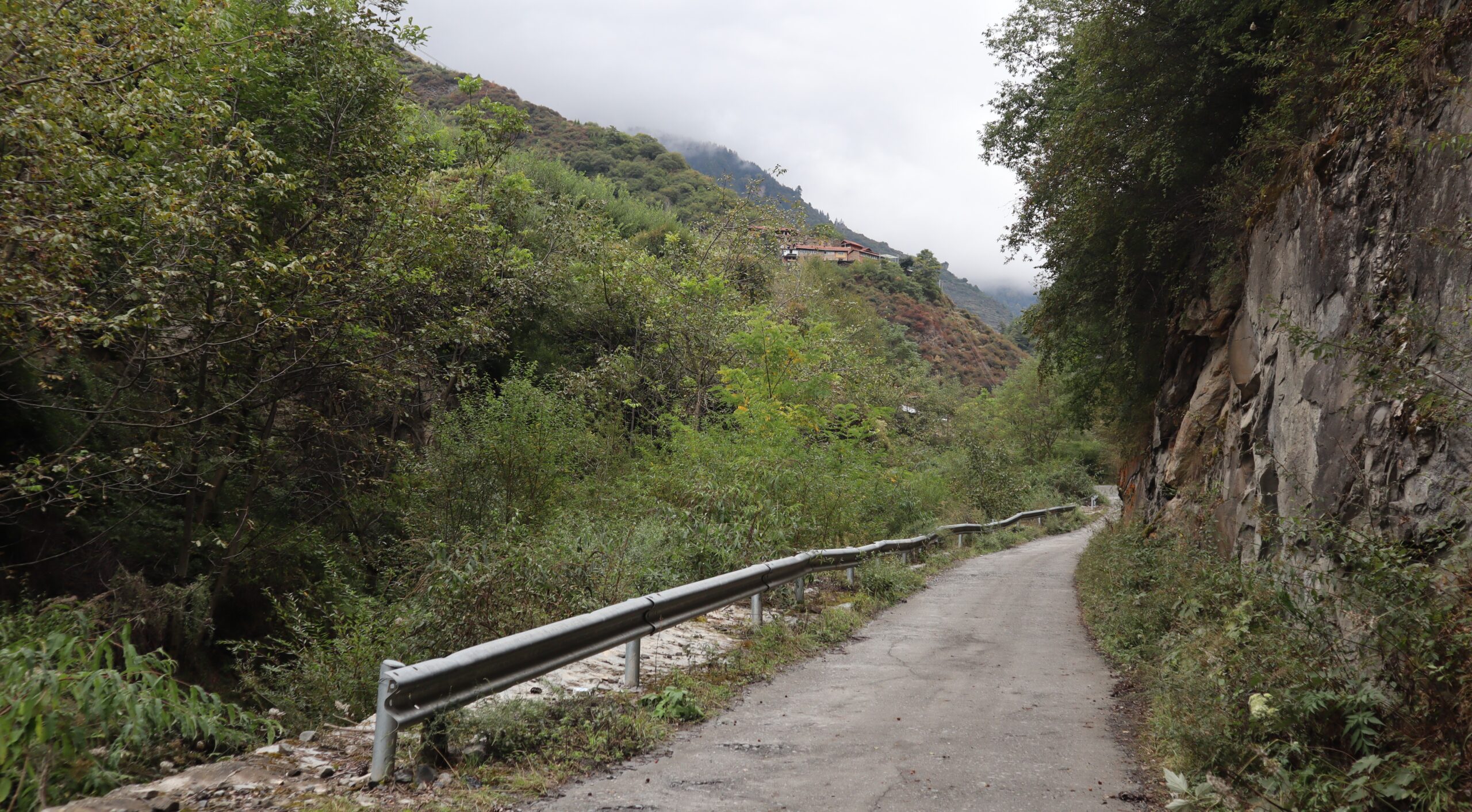
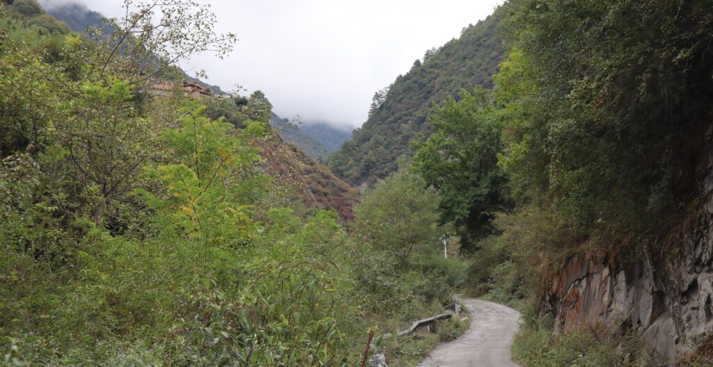
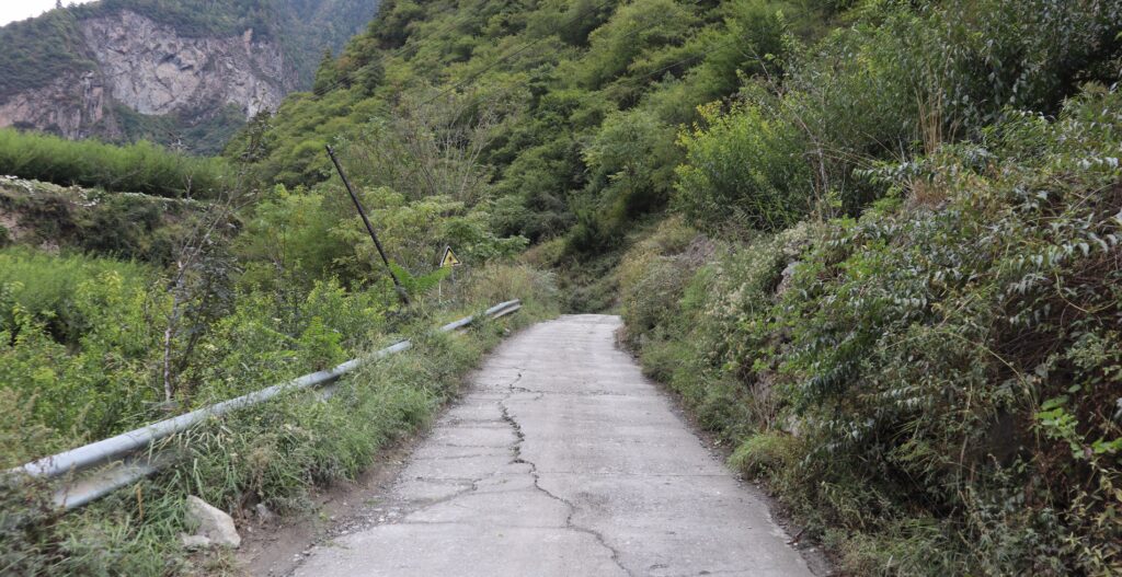
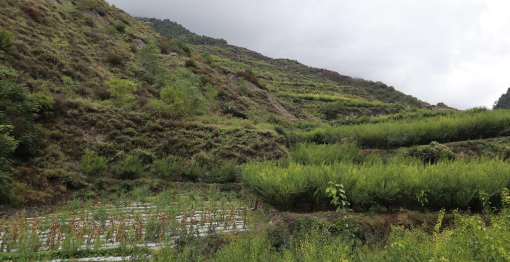
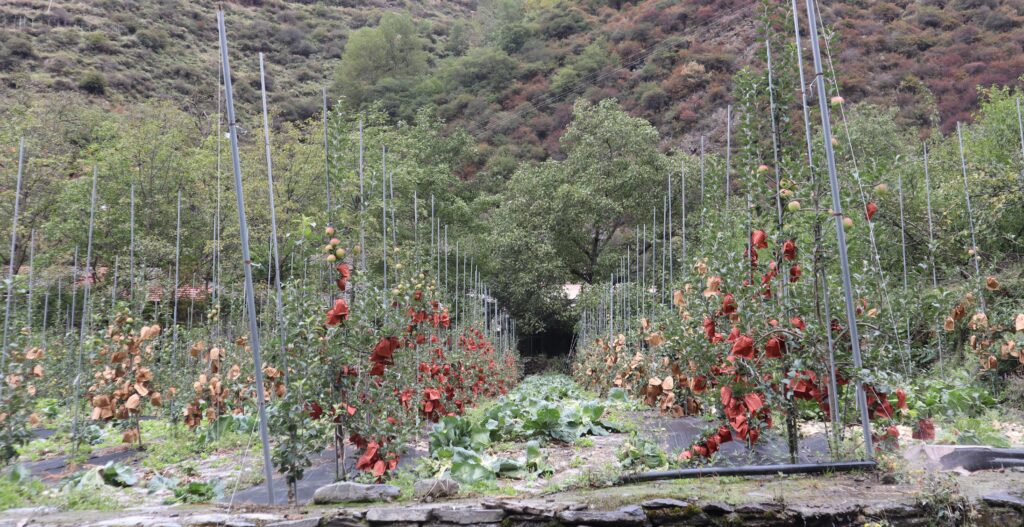
Continuing on the road is an uphill venture. It’s not especially difficult. The road is easy to follow. There are frequent branches from both sides, leading to homes and small communities. Some are active, not all. And a lot of structures which just sit right by the road. There are also many plots and terraces right along it, usually with customary partitioning- slight inconvenience seems to do the job of a gate. These areas mostly grow the usual stuff, pumpkins too.
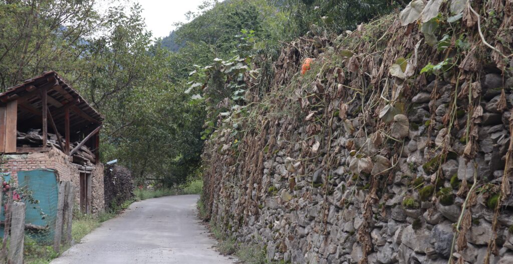
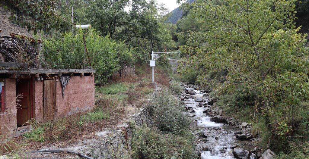
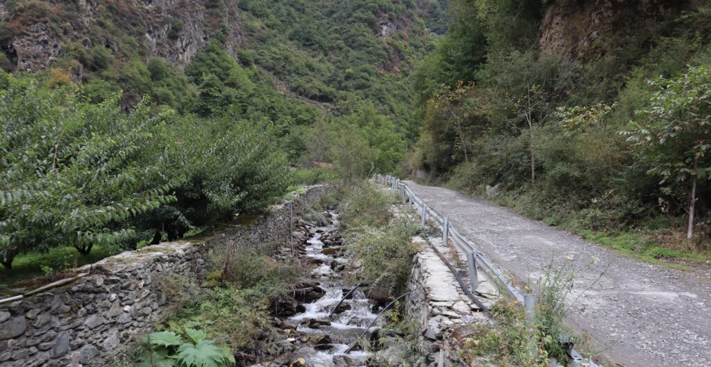
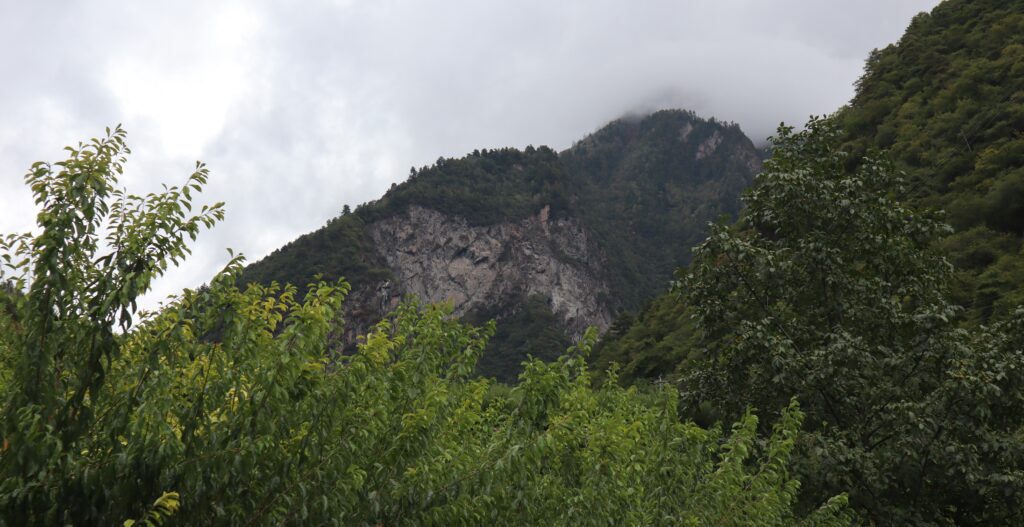
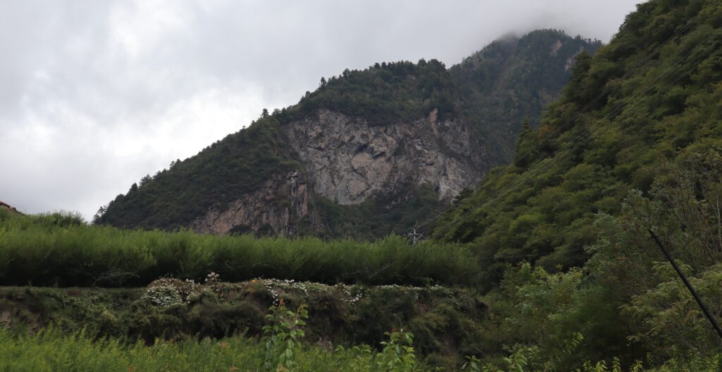
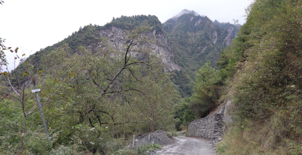
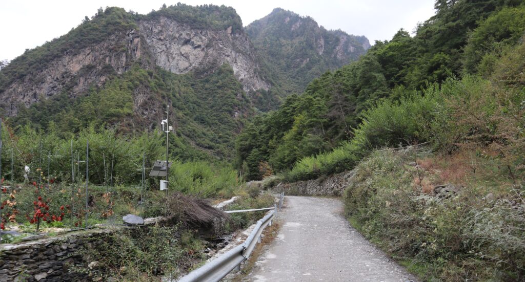
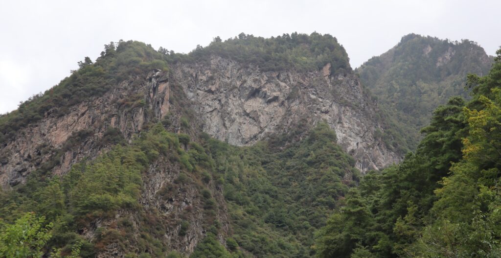
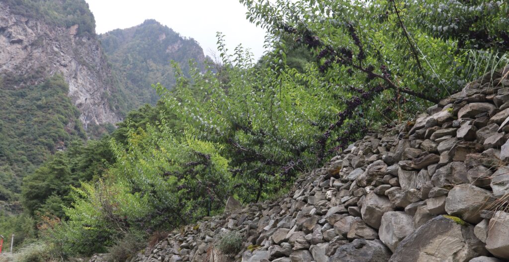
Long stacks of stones alternate with steep and jagged rock faces and other natural buildup on the right side of trail (when going upward), forming a kind of enclosure on the one side. The left side, for much of the trail, is more expansive, blanketed with vegetation, or births to small groups of dwellings, while occasionally opening up to reveal an awesome landscape. This side is sometimes accompanied by a simple railing. There are also segments where water streams through next to the path.
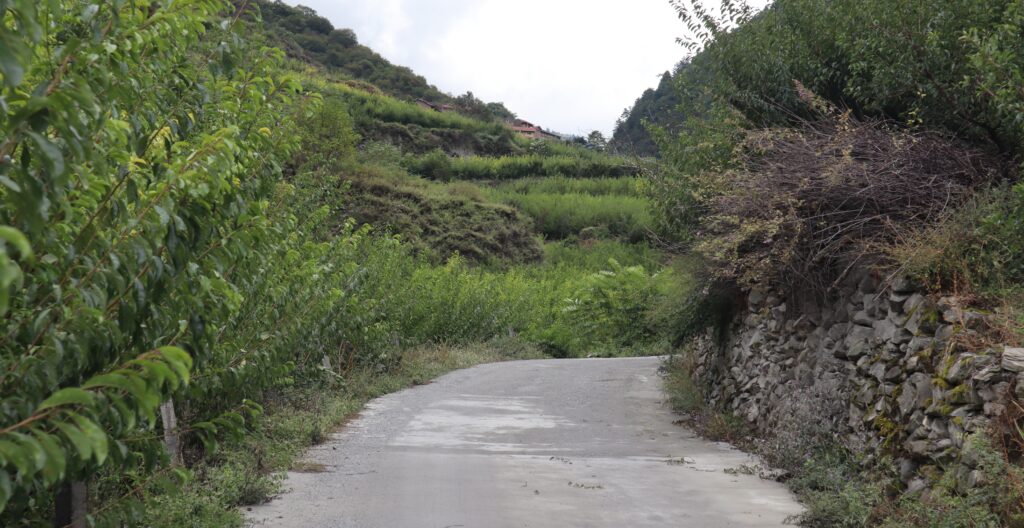
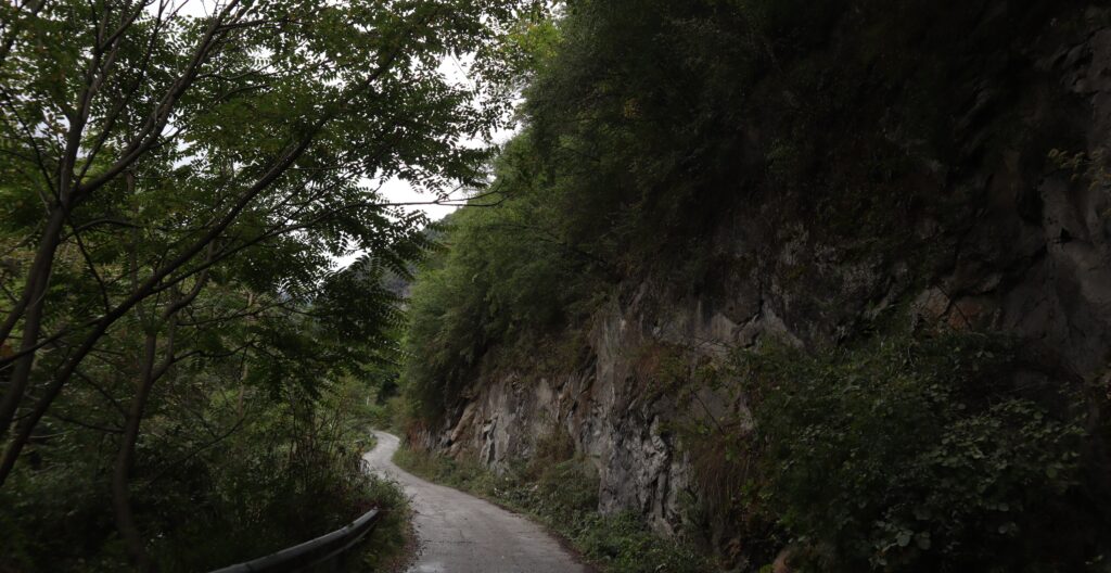
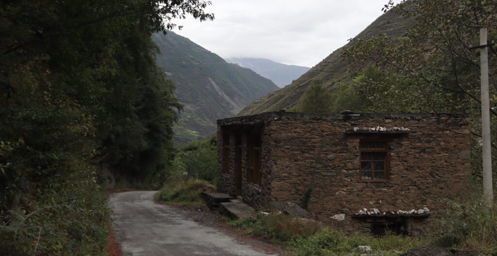
The road transitions into a rougher surface as we march up but always remains comprehensible. And perfectly functional throughout, for the length I traversed at least. It’s a really incredible resource, undeniably essential. And firmer than it looks.
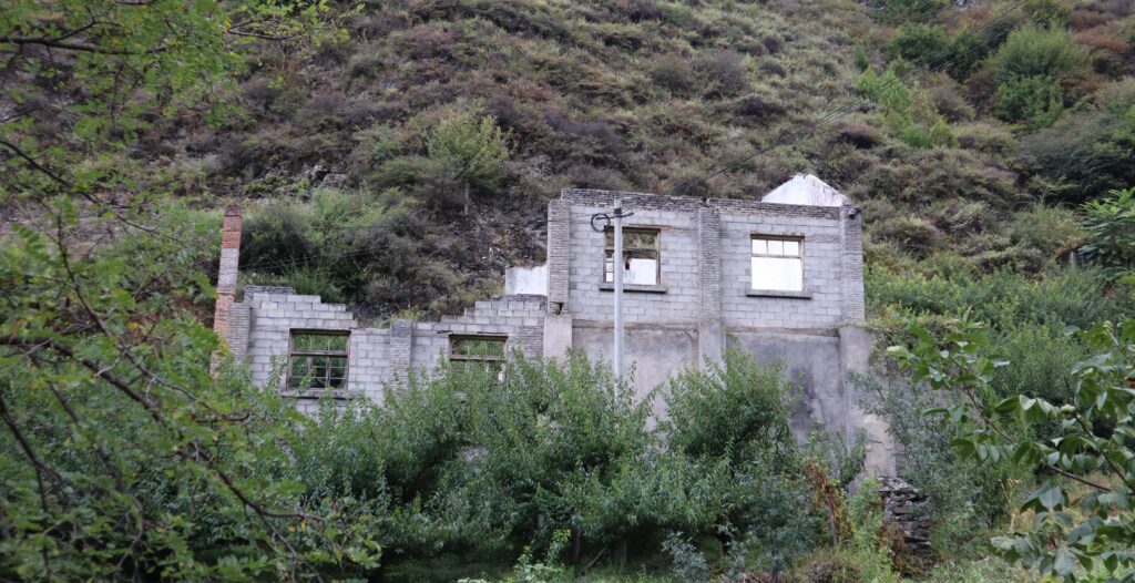
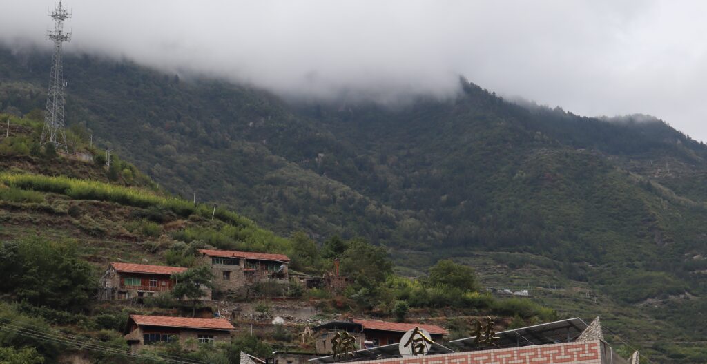
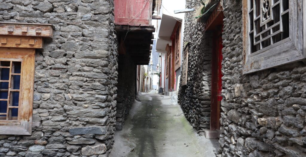
The households here typically look like the usual traditional Qiang style, without much window dressing for visitors. A degree of the hodgepodge element that I have come to believe is frankly quite authentic. Many more structures are somewhat tucked away from the road or behind trees and stuff, anyway.
Some of the homes built higher in the mountains can look intriguing and extensive.
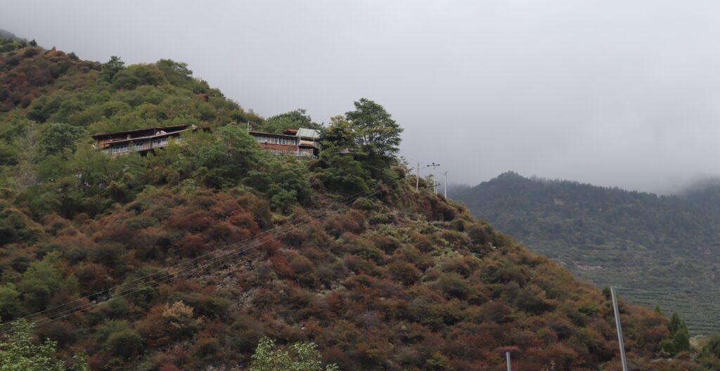
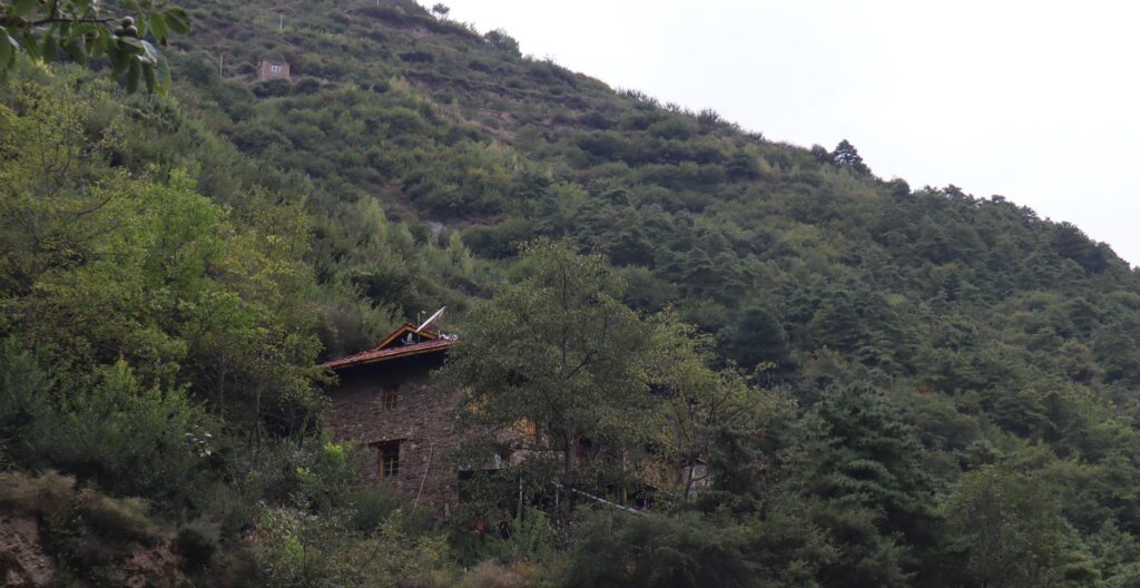
The homes are just a piece of the greater landscape.
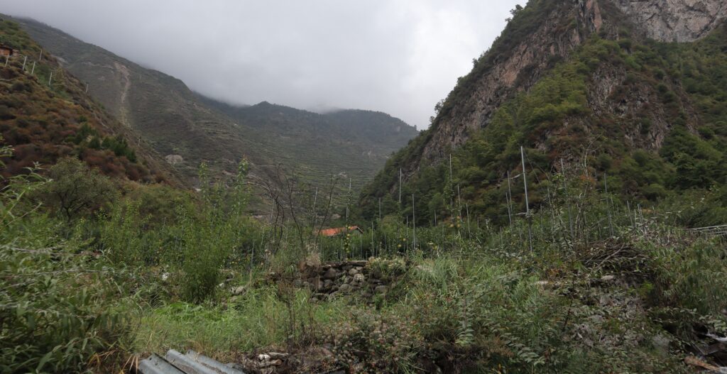
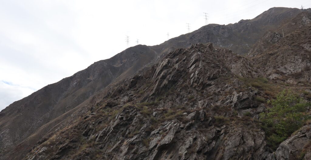
At times the path bends a certain way, offering an unexpectedly grand field-of-view. One can easily see the road in front of them for some distance, with some allocation of cultivation or homestead on each side, while a mountain occupies the middle space as if the road leads right through it. It doesn’t, of course. It goes around, creating variations of this scene further ahead I’m sure, however many times for however long.
I only wish I captured more pictures of this mountain, and in more ways … sometimes, there is simply a necessary feeling.
But I don’t want to just photograph mountains and skies and roads and architecture, I have to remind myself. People live here for a reason, and it isn’t because the mountains make them feel good. It’s a habitat, familiar and providing.
I am glad to be able to see all this, all while never having to leave this one road.
A jaunt back down to our starting point and we depart. Right before I leave, I see a cat, watching me as it moves. Seems like the only other living thing in the area that isn’t staying still. But I gotta go, there is another spot in Shaba to see.
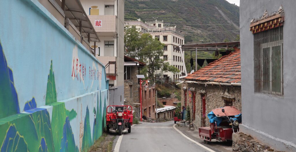
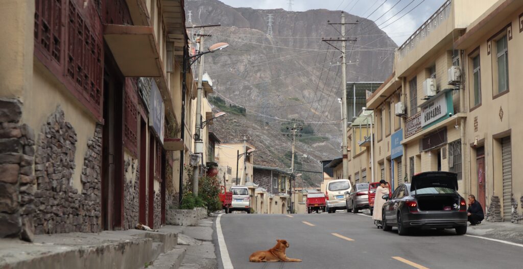
Landed. Different part of town, still Shaba, I’m 80% sure of that. At first glance… a little bit formulaic. I mean, it’s perfectly pleasant. New shade of tan/clay/beige maybe, but I’ve seen this before. Anyway, this is only just the veneer. It’s the busy road section of a small community, low building rows uniformly shaped, designed. Feels like they all got done at the same time. One might (wrongly) assume there to be more businesses than people. And there aren’t that many businesses. Could just be I came at the wrong time. I guess it’s tempting, and perhaps over-judicious, to compare with places such as what we just saw before. The only way to be fair is to see everything. Which I can’t do, but I can attempt to.
A positive remark: no lousy and jarring welcome signs in my face that ruin the earthy-colors theme (which is unbeatable). Still, need to go see the streets where the cars aren’t driving through.
What I am looking for is not at all hard to stumble upon.
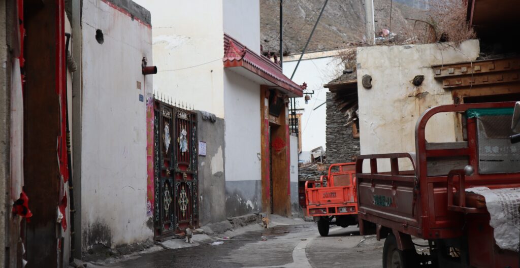
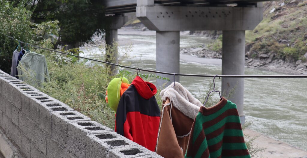
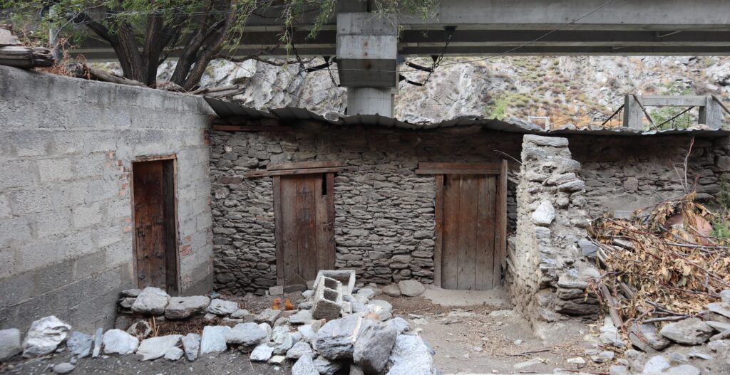
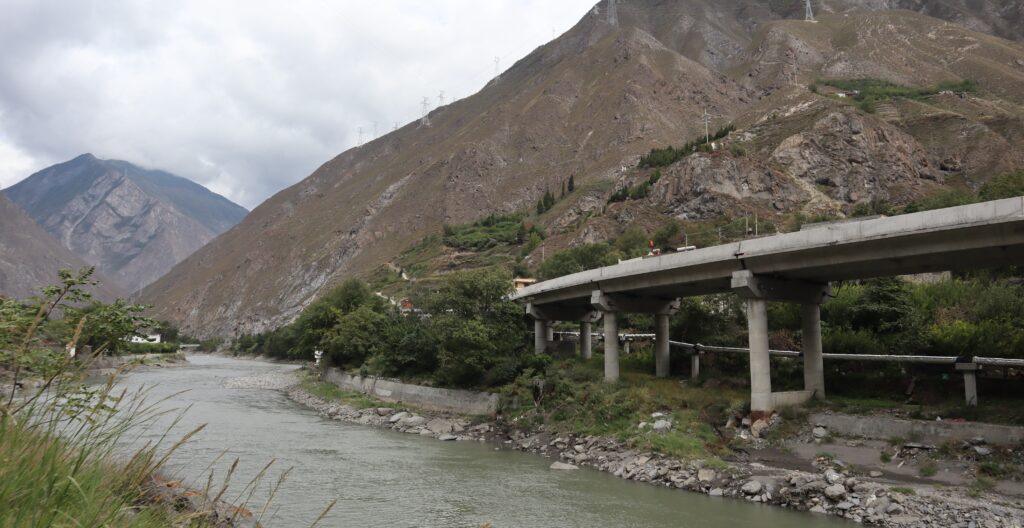
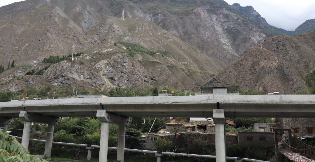
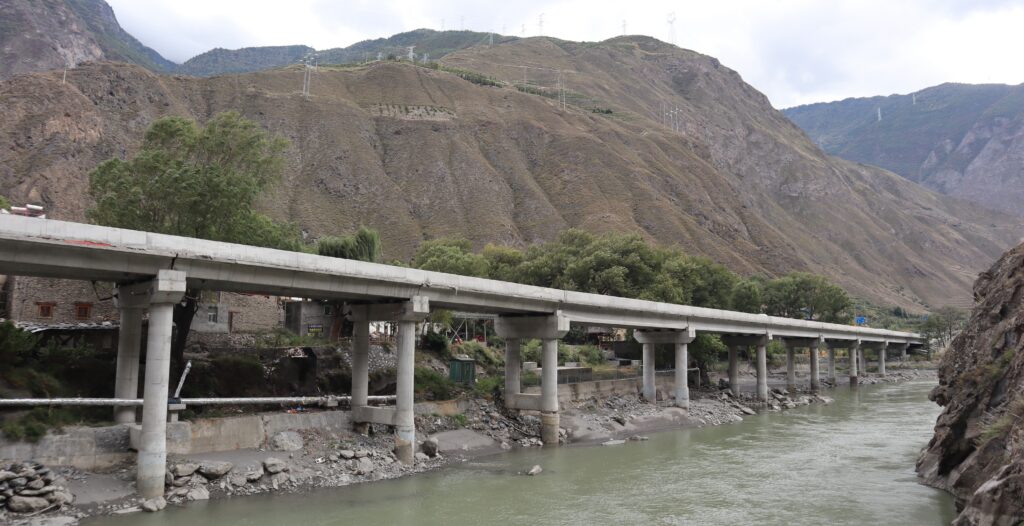
It’s a place with two faces. Or rather, a spectrum. The aforementioned exterior on one side… and the aging, not-close-to-the-street, mixed materials side. What makes it striking to me is the big highway structure that looms over the very edge of the neighborhood. While it appears to manage avoiding physically impeding anything the neighborhood, it obstructs a lot of view- from both the outside and inside of the neighborhood.
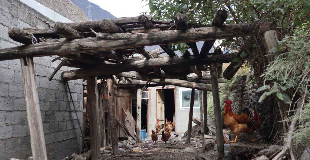
The chickens are friendly, totally unbothered.
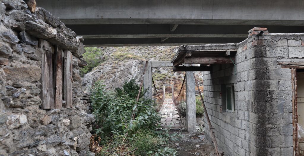
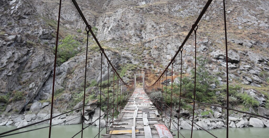
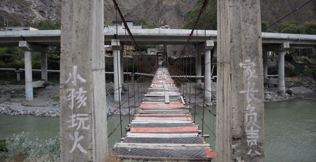
The highlight for me is the bridge under the highway, which crosses over the river to an undeveloped side. Lots of neat perspectives to capture, thanks to the bridge.
Although it looks wonky, it was pretty sturdy! Just keep track of the nailed-down planks.
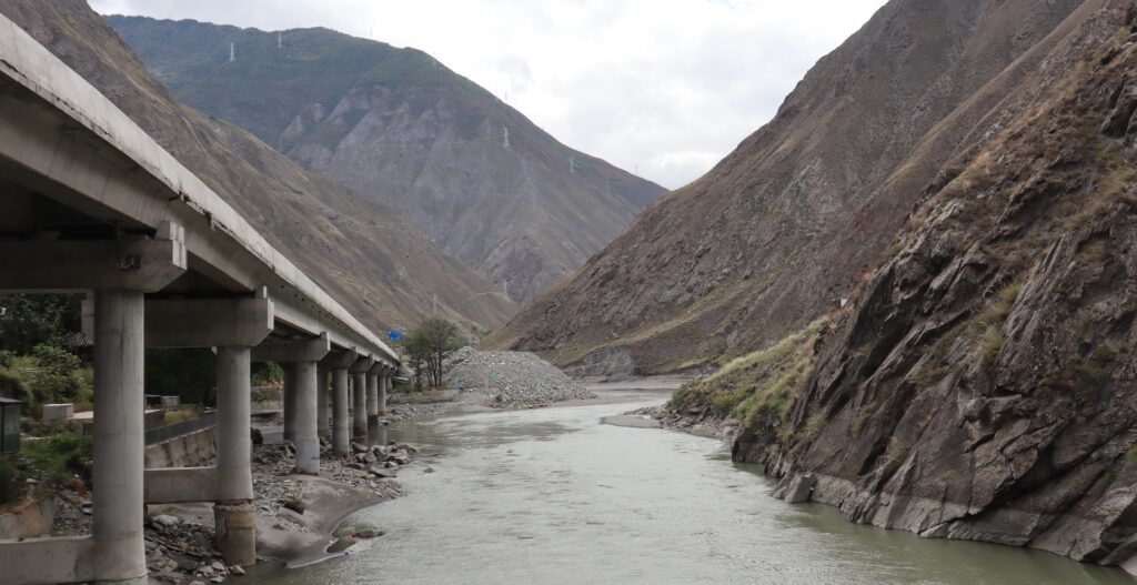
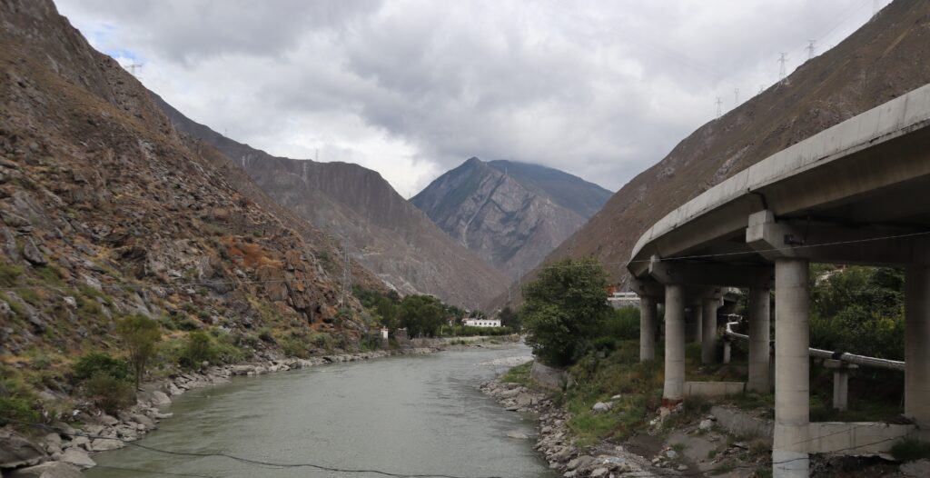
Tried to get good shots capturing how the silhouette and character of the neighborhood are impacted by the highway structure. Maybe more photos than necessary, but I think it helps to provide a vision of the neighborhood and surrounding environment as it was in previous form.
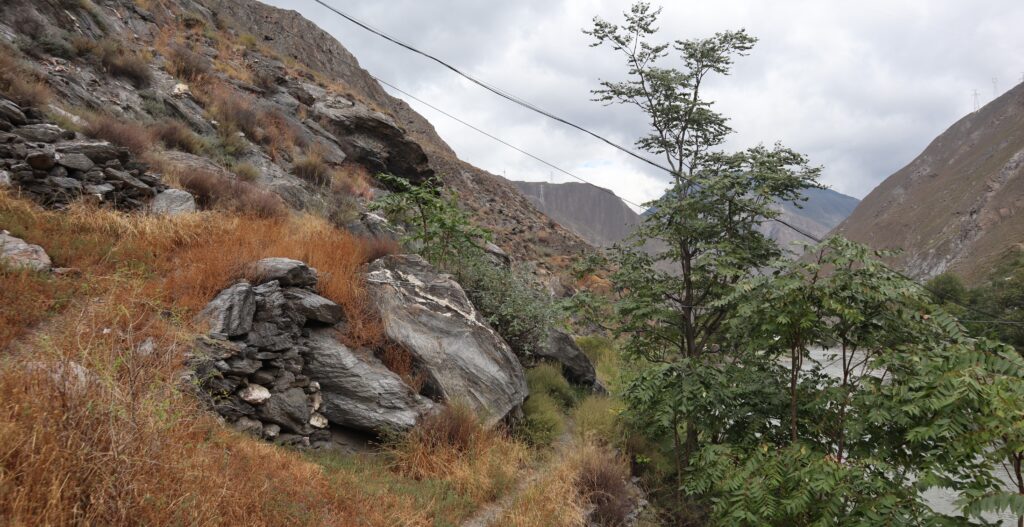
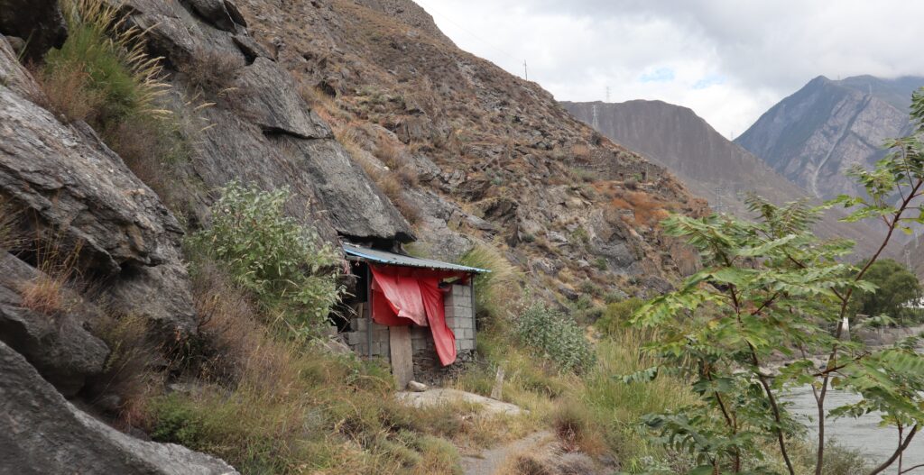
On the other side of the bridge is very cool. There is a rough trail, and very little infrastructure of any kind. But clearly there is somebody still roaming around this area. Maybe not frequently, or maybe it’s just part of a route to somewhere else. All peaceful.
Leave a Reply